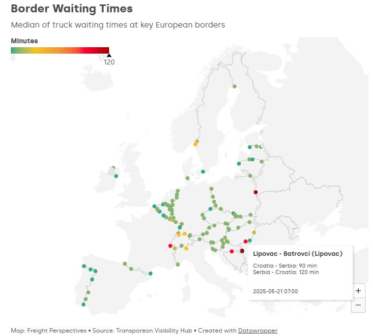
With a new digital application, Transporeon, part of the Trimble Group, aims to provide more transparency in European road freight transport. The company has released an interactive border status map that displays the waiting times for trucks at European borders almost in real time. The goal is to give
carriers, shippers, and logistics service providers a tool to respond more quickly to disruptions in cross-border transport.
The map is based on Transporeon's real-time visibility data and is updated every four hours. This gives users a current overview of potential delays at border crossings. For example, the temporary reintroduction
of border controls within the EU and seasonal traffic loads regularly affect the planning along central corridors.
Live map and weekly delay index
“Real-time transparency is now an integral part of modern transport strategies,” Transporeon emphasizes in the announcement. The new map helps companies recognize operational impacts early, manage
capacities more flexibly, and keep supply chains stable.
In addition to the live map, Transporeon provides a weekly updated delay index for German borders. This is planned to be expanded to other countries in the medium term.
The border status map is publicly accessible on the Freight Perspectives platform